Road Signs : Effectiveness in Addressing Traffic Accidents
Car accidents are huge costs to government, and to the loss of life.
Based on the comprehensive, open data on crashes and regulatory signs' installation details from Main Roads Western Australia, we strive to investigate and address the problem in exploratory means.
We spatially visualised the car crash hotspots aggregated over the years (2011-2015)
- Optimised hotspot analysis based on clustered data points, accounting for the severity level ranging from Minor Property Damage (1) to Fatal (5)
- Interpolated the spatial data with inverse distance weighted (IDW) algorithm
To look into the problem further, we want to answer the essential question surfaced :
Can road signs reduce traffic accidents?
Methodology and Findings
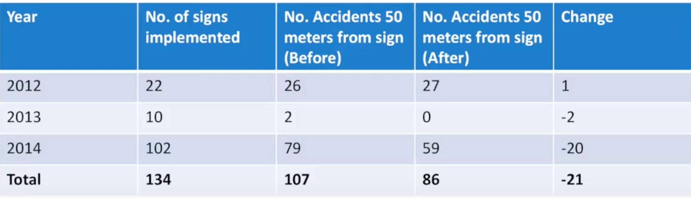
We linked the accident counts (in the year before and after) within a 50 meters proximity to each new regulatory sign installation, via Spatial Join tool. Then we summarised and normalised the differences over the years, and estimated that the accidents within 50 meters of the sign were reduced by 15% for every new sign added.
Implications
For the purpose of this project, we only investigated at the Perth Metropolitan Scale. Future development can incorporate machine learning algorithm to facilitate the identification of high risk areas based on the road patterns, in order to recommend optimal locations for new signs installation in future.
In development...
Please note that at this stage of development, there might be potential boundary issues with aggregation under hotspot analysis.